When Every Glove Compartment Held America's Geography: The Ritual of Planning Roads Before Satellites Knew Where You Were
The Sacred Ritual of Sunday Planning
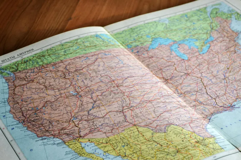
Picture this: It's 1985, and the Johnson family is planning their summer vacation to Yellowstone. Dad spreads the Rand McNally Road Atlas across the dining room table, its spine cracked from years of use, pages soft as fabric from countless foldings. Mom traces possible routes with her finger while the kids argue over whether to take the scenic route through Colorado or the faster path through Nebraska. Red pen marks from previous trips create a web of memories across the pages — "Great diner here!" scrawled next to a tiny dot in Kansas, "Awful motel — never again" written beside an exit in Oklahoma.
This wasn't just trip planning. This was America learning its own geography, one highway at a time.
The Weight of Paper Geography
The road atlas was heavy — not just physically, though those thick books could easily weigh three pounds, but conceptually. Opening one meant committing to understanding space and distance in a way that required genuine mental effort. You couldn't just type in an address and follow blue arrows. You had to comprehend scale, calculate mileage, and make decisions about trade-offs between time and scenery.
Every atlas told stories through its wear patterns. The pages covering popular vacation routes — Florida, California, the Great Smoky Mountains — became dog-eared and stained. Lesser-traveled sections remained pristine, waiting for the day someone might venture into the Dakotas or explore the upper reaches of Maine. These books became archaeological records of American wanderlust.
When Getting Lost Required Actual Skill
Navigating with an atlas demanded skills that seem almost quaint today. You had to maintain spatial awareness, constantly updating your mental map as you drove. Exit numbers mattered. Compass directions weren't just abstract concepts — they were essential tools for survival on the interstate. A family could spend twenty minutes at a truck stop, atlas spread across the hood, trying to figure out where they'd taken a wrong turn.
Getting lost wasn't a minor inconvenience solved by recalculating a route. It was a genuine adventure that could add hours to a journey and often led to discoveries no algorithm would ever suggest. How many roadside diners, quirky tourist traps, and scenic overlooks were found by families who'd misread their atlas and ended up on an unplanned detour?
The Democracy of the Backseat Navigator
The atlas created a unique form of family democracy. Everyone could participate in navigation, from the eight-year-old tracing the route with their finger to grandma sharing stories about towns she'd visited decades earlier. The designated "navigator" — usually mom — held genuine authority, calling out upcoming exits and warning about construction zones marked in the margins.
This shared responsibility created investment in the journey itself. Kids learned state capitals not from textbooks but from following highways. They understood that Wyoming was really, really big and that you could drive for hours in Texas without seeming to make any progress on the map. Geography became visceral, not abstract.
The Art of the Annotated Journey
Perhaps most remarkably, families treated their atlases like living documents. They wrote in the margins, circled favorite stops, and crossed out routes that had disappointed them. Some families used different colored pens for different years, creating a multicolored history of their travels. These annotations transformed a mass-produced book into a personalized record of adventures and misadventures.
A well-used atlas might include notes like "Bridge out — use Route 34" or "Best BBQ in Missouri — exit 127." These handwritten additions made each atlas unique, a family heirloom that captured not just geography but memory.
What Disappeared When the Voice Started Talking
When GPS navigation arrived, it promised to eliminate the frustration of getting lost, the arguments over directions, and the anxiety of missing crucial turns. And it delivered on those promises. But it also eliminated something less tangible: the intimate relationship Americans had developed with their country's physical layout.
Today's travelers move through space passively, following instructions without understanding context. They might drive from Denver to Salt Lake City without realizing they've crossed the Continental Divide, or travel from Chicago to Milwaukee without grasping how the Great Lakes shape the region's character. The journey has become a series of turn-by-turn instructions rather than a navigation through comprehensible geography.
The Lost Art of Preparation
Modern navigation is instant and effortless, but the atlas era required preparation that enhanced the travel experience. Families spent evenings before departure studying their route, discussing alternatives, and building anticipation for specific landmarks and stops. This preparation created shared excitement and gave everyone a role in the adventure.
The atlas forced travelers to think strategically about their journeys. Which route offered the best scenery? Where should they stop for lunch? How many hours of driving could they realistically handle in a day? These questions required thoughtful consideration rather than algorithmic optimization for speed or traffic avoidance.
More Than Navigation, A Connection to Place
The road atlas represented something profound about American mobility: the idea that understanding your country's geography was both a practical necessity and a form of citizenship. Those heavy books connected travelers to the vastness and diversity of the American landscape in ways that GPS navigation, for all its convenience, simply cannot.
When the last atlas finally migrated from glove compartment to garage sale, America didn't just lose a navigation tool. It lost a ritual that had, for generations, transformed the simple act of getting from point A to point B into a genuine exploration of place, family, and the endless highways that bind this enormous country together.